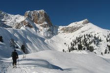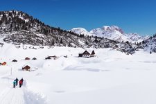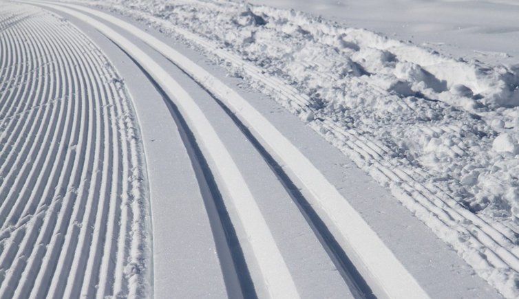
The network of cross-country ski runs in the Val Pusteria comprises many runs of every difficulty for both beginners and experts
Image gallery: Cross-country ski runs
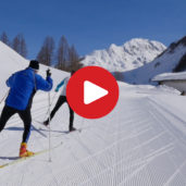
No matter if you are a beginner or a real cross-country ski expert, the Val Pusteria has the right runs for everybody. In fact, you can explore the beautiful winter landscape of the Val Pusteria both on easy bottom valley runs and more challenging high altitude runs. The most famous cross-county ski areas are in East Tyrol, the Upper Val Pusteria and the Valle di Casies. The following list contains the most important cross-country ski runs in the Val Pusteria:
Upper Val Pusteria - Sesto
- Restaurant „Alte Säge” - Ferrara: 1.4 km, medium
- Ferrara - Waldheim: 2.4 km, medium
- Waldheim - Mühlenhof: 1.8 km, medium
- Mühlenhof - Piano Fiscalina: 2.1 km, medium
- Circular Trail Val Fiscalina: 5 km, easy
- Circuit Prato Larici: 3.3 km, difficult
- Circuit Schönfelder: 1.4 km, easy
- Night slope Cicuit Waldheim: 1.2 km, easy
- Circuit Moso: 1.1 km, easy
- Ski-touring trail: 7 km, medium
Upper Val Pusteria – San Candido
- Chairlift Baranci – direction Dobbiaco (forest): 2.9 km, medium
- Chairlift Baranci – direction Dobbiaco (meadow): 4 km, easy
- Hotel Capriolo – Dobbiaco: 4 km, easy
- Hotel Brandl – state border (A): 6.1 km, easy
- Hotel Brandl – Versciaco: 3 km, easy
- San Candido – Sesto (Restaurant Alte Säge): 4 km, medium
Upper Val Pusteria – Dobbiaco
- Cross country Stadio Track Dobbiaco: 1.4 km, easy
- Cross country Stadio Dobbiaco FISI – Stephanie: 3.9 km, difficult
- Cross country Stadio Dobbiaco FISI – Ole: 4.2 km, difficult
- Cross country Stadio Dobbiaco FISI – Nathalie: 5.5 km, difficult
- Cross country Stadio Dobbiaco FISI – Saskia: 5.3 km, difficult
- Connection Lake of Dobbiaco: 0.4 km, medium
- Round of the Lake of Dobbiaco: 7.2 km, easy
- Round Vista Three Peaks: 2.8 km, easy
- Cimabanche – Cross Country Stadio Nordic Arena (variant): 17.3 km, medium
- Round Val Fonda: 2.1 km, difficult
- Cross country Stadio Dobbiaco – Cimabanche: 16.8 km, medium
- Cross country Stadio Dobbiaco – Fiames (lungo il percorso Tour de Ski): 26.3 km, medium
- Track around the village of Dobbiaco: 4.5 km, easy
- Cross country Stadio Dobbiaco – direzione San Candido: 2.3 km, medium
- Cross country Stadio Dobbiaco – direzione Villabassa: 3.2 km, medium
- Sun track Dobbiaco in direzione Villabassa: 1.3 km, easy
- Sun track Dobbiaco – Santa Maria: 2.3 km, easy
- Carbonin – Prato Piazza: 7 km, difficult
Upper Val Pusteria – Villabassa
- Cross country Pustertaler Skimarathon / Grabach - Dobbiaco: 1.7 km, easy
- Cross country Pustertaler Skimarathon / Villabassa train station - Grabach: 1.2 km, medium
- Cross country Pustertaler Skimarathon / Villabassa train station - confine Braies: 2.7 km, medium
- Cross country Pustertaler Skimarathon / Dobbiaco - Braies: 5.4 km, easy
- Cross country sun Villabassa - Dobbiaco: 3.2 km, easy
- Cross country sun „Hirbenfelder” circuit: 1.1 km, easy
- Cross country Olympia circuit: 1 km, easy
- Cross country Pian i Maia circuit: 1.7 km, medium
- West cross country – Villabassa train station - Monguelfo: 6 km, easy
- Cross country Pustertaler Skimarathon / Villabassa train station - Ferrara di Braies: 4.4 km, easy
Upper Val Pusteria – Braies
- Segheria - circle - Untergasse: 3.7 km, easy
- Segheria - Mösslhof: 6.2 km, difficult
- Circle Ferrara: 2 km, easy
- Segheria - Braies Vecchia (skilift): 4.9 km, difficult
- Braies Vecchia (skilift) - Ponticello: 3.2 km, medium
- Circuit Braies Vecchia: 1.9 km, easy
- Circuito Prato Piazza: 6.5 km, medium
Valle Anterselva
- Circuit biotope: 3 km, easy
- Anterselva di Sotto - Anterselva di Mezzo: 3.9 km, medium
- Anterselva di Mezzo - Anterselva di Sopra: 4.4 km, difficult
- Anterselva di Sopra - Biathlon Centre Anterselva: 1.4 km, difficult
- Forest trail: 1.1 km, medium
- del sole: 5.5 km, easy
- Lake Anterselva: 2.4 km, easy
- Circuit masi Walder: 1.3 km, easy
- Rasun di Sotto - Rasun di Sopra: 3.5 km, easy
- Rasun di Sotto: 2.5 km, easy
- Cross Country Trail Biathlon Centre Anterselva: 17.5 km, medium
Valle di Casies
- Nordic Hero Champ Nordic Arena - Val Casies Valley: 42 km, easy
- Nordic Hero Champ Sesto - Nordic Arena; 47.9 km, easy
- Circuit Mooswald / Val Casies Valley: 2.3 km, easy
- Connection Monguelfo - 3 Zinnen Dolomites: 3.6 km, easy
- Connection Tesido to Val Casies Valley track: 1.8 km, easy
- Cross Country Track Val Casies Valley: Monguelfo - S. Maddalena / head of the valley: 14.8 km, easy
East Tyrol
- Kristeinertal bei Anras: 2.5 km, medium
- Winkeltal: 4.3 km, medium
- Rabland Circuit: 2.9 km, easy
- Villgratental: 9.5 km, medium
- Panorama slope Kals: 2.5 km, medium
- Promenaden slope Kals: 6.4 km, easy
- Romantik slope Kals: 3.6 km, easy
- Sonnen slope Kals: 3 km, easy
- Talblick slope Kals: 3 km, easy
- Tauern slope Kals: 2.2 km, easy
- Exercise slope Kals: 0.5 km, easy
- Dorfberg: 10 km, medium
- Circuit Lavant: 5 km, easy
- Warm-up slope: 1.6 km, medium
- Biathlon centre Obertilliach: 5.5 km, easy
- Grenzland slope: 25.6 km, medium
- Slope Golzentipp Obertilliach: 3.1 km, medium
- Schwalen circuit: 4 km, medium
- Blusen circuit: 1.4 km, easy
- Bobojach slope: 7.4 km, difficult
- Isel slope Hinterbichl: 6.9 km, medium
- Slope Unterfeld: 3.3 km, easy
- Panorama slope Ströden: 2 km, easy
- Connection slope Panorama: 2.6 km, difficult
- Connection slope Hinterbichl: 2.6 km, difficult
- Border slope: 11.2 km, easy
- Pustertal slope: 31.9 km, medium
- Sonnen slope Sillian: 0.2 km, easy
- Feistritz slope: 4.3 km, difficult
- Slope Staller Sattel, 7.4 km, difficult
- Oberseer slope: 4.5 km, medium
- Schwarzach slope Hopfgarten: 7.7 km, medium
- Schwarzach slope St. Veit: 6 km, medium
- Schwefelbrunn slope: 3 km, easy
- Sonnen slope St. Jakob: 1.8 km, easy
- St. Jakob – Erlsbach: 6.6 km, medium
- St. Jakob – Maria Hilf: 2.8 km, easy
- St. Leonhard slope: 5.1 km, medium
- Exercise slope St. Jakob: 0.7 km, easy
- Slope Strassen: 2.3 km, easy
- Strassener Möser slope: 2.3 km, easy
Valle Aurina
- Cross Country Sun Trail Casere: 10 km, medium
- Cross Country track Rio Bianco: 10 km, medium
- Circle Riva di Tures: 3 km, medium
- Cross Country track Molini Lappago: 16 km, medium
Brunico and surroundings
- Riscone: 5.5 km, easy
- Falzes / Issengo: 2 km, easy
Lower Val Pusteria
- Rodengo – Luson: 11.5 km, easy
- Lobenweg – Rifugio Bacherhütte from the parking Valle di Altafossa: 9.1 km, easy
- Circuit Valles from the valley station Jochtal: 4.5 km, easy