In the water-rich Valle Selva dei Molini lie Lake Neves and the Ponte di Ghiaccio Hut on the Neves High Route
Image gallery: Hike from Lake Neves to the Ponte di Ghiaccio Hut


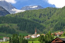
Our summer hike in the Valle di Tures takes us this time into the Valle Selva dei Molini, a side valley known for its abundance of water and related themed trails. From the hamlet of Lappago, the toll road winds its way up to Lake Neves. The mountain lake is surrounded by the rocky giants of the Zillertal Alps, with a beautiful alpine landscape stretching all around. From the car park at an altitude of 1,860 metres, we look out over the lake and can see the Neves Hut on the opposite shore, along with the valley that leads up to the Rifugio Ponte di Ghiaccio (Edelrauthütte).
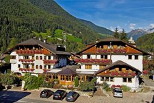
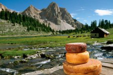
We set off and soon come to a fork where trail no. 26 leads left over a bridge. It takes us directly to the Neves Hut, which is known for its cheese. The view extends to Mt. Cima di Campo and Mt. Gran Mèsule: At 3,478 metres, this peak is the second-highest mountain in the Zillertal Alps and was first climbed in 1865. After the hut, a forest road leads us into the woods. Once we leave the trees behind, the alpine meadows open up. The signs consistently point towards "Edelrauthütte".
The ascent takes about two hours. The path is not overly steep, and we sometimes encounter a few cows grazing in the alpine meadows. The final section then becomes steeper and more strenuous, and we start to work up a sweat. But then we see it ahead of us: the Rifugio Ponte di Ghiaccio at an altitude of 2,545 metres. It is managed from June to October and has been defying the harsh elements since 1908. The new building was opened in 2015.
We take a look at Lake Ponte di Ghiaccio below and then stop for a break: On the sun terrace, you can enjoy speck and cheese from farms in Fundres and Lappago, as well as dishes made from old South Tyrolean recipes. Afterwards, we head back to Lake Neves along the same path.
Authors: Elena & Luca
Date of the hike: August 2020
Last updated in: 2026
-
- Starting point:
- Lake Neves, last car park at the lake (1,860 m a.s.l.)
-
- Overall time:
- 03:40 h
-
- Total route length:
- 9,3 km
-
- Altitude:
- from 1.860 m to 2.545 m
-
- Altitude difference (uphill | downhill):
- +685 m | -685 m
-
- Signposts:
- 24, 26
-
- Destination:
- Ponte di Ghiaccio Mountain Hut (2,545 m a.s.l.)
-
- Resting points:
- Untermaurer Hut, Neves Hut, Ponte di Ghiaccio Hut
-
- Recommended time of year:
- Jan Feb Mar Apr May Jun Jul Aug Sep Oct Nov Dec
-
- Download GPX track:
- Hike from Lake Neves to the Ponte di Ghiaccio Hut
-
- More information:
- Be aware of possible snowfall in autumn! The overall time shown above refers to the walking time only, not including breaks or stops at mountain huts.