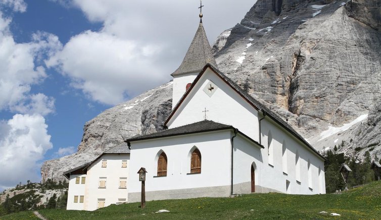
The Rifugio Santa Croce in Badia is the starting point for our hike to Sasso delle Dieci (3,026 m a.s.l.) in the Sasso della Croce group
Image gallery: Hike to the Sasso delle Dieci
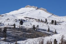
The Sasso delle Dieci (Sas dles Diesc in Ladin) is situated in the Dolomites and more precisely in the Sasso della Croce group, a mountain range overlooking the Val Badia at the western border of the Gruppo Fanes. The starting point of this hike is accessible from the Val Badia and S. Leonardo. We take the cable car towards Santa Croce and get off at the middle station at 1,841m a.s.l. (this path can also be walked). At the middle station we take path no. 7 and reach the hospice after a 30-minute walk. This listed building dating to 1718 is a mountain hut and restaurant at 2,045 metres of altitude in the Fanes-Sennes-Braies nature park.
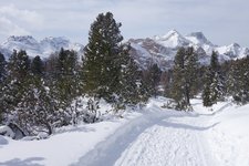
We head towards south and walk past the rocks of the Fanes high plateau. The path winds across stone and mountain pine forests. Then we continue along the secured path below the rock walls until a lower plain where we leave path no. 7 and continue towards the ridge. Towards north we see the pyramid-shaped peak. Slightly before the peak of Sasso delle Dieci lies a fork where we keep to the right.
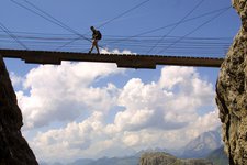
The last section is very exposed and requires absolute sure-footedness and freedom from vertigo, as well as mountain experience. The view you can enjoy from the summit of Sasso delle Dieci at 3,026 metres of altitude is truly impressive: from here you can admire several dolomitic peaks including the Croda Rossa d'Ampezzo, Monte Cristallo, the Sorapiss group, the Tofane, the Marmolada (with an altitude of 3,343 m a.s.l. the highest peak of the Dolomites), the Sella group with Piz Boé, the Sassolungo, the Gruppo delle Odle, the Gruppo del Puez and Sass de Putia.
-
- Starting point:
- Mountain station La Crusc 1
-
- Overall time:
- 06:00 h
-
- Total route length:
- 14,3 km
-
- Altitude:
- from 1.841 m to 3.025 m
-
- Altitude difference (uphill | downhill):
- +1234 m | -1234 m
-
- Route:
- Mountain station La Crusc 1 - Holy Cross Pilgrimage Church - Mt. Sasso di Santa Croce - Mt. Sasso delle Dieci
-
- Signposts:
- 15, 7, 7B
-
- Destination:
- Sasso delle Dieci
-
- Recommended time of year:
- Jan Feb Mar Apr May Jun Jul Aug Sep Oct Nov Dec
-
- Download GPX track:
- Hike to the Sasso delle Dieci
If you want to undertake this hike, we recommend you to check the weather and trail conditions in advance and on site before setting out.