The Monte Lovello with its subsidiary summits Kleiner Löffler and Tribbachspitze is part of the Zillertal Alps
Image gallery: Monte Lovello


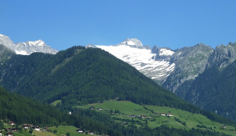
The south ridge of the 3,379 m high Monte Lovello (Großer Löffler in German) is one of the spots along the state border between Italy and Austria. To the south, the mountain slopes into the Valle Aurina valley, to the north into the Zillertal valley.
The mountain which is surrounded by glaciers, was climbed for the first time in 1843. Until then, it was often termed as the highest mountain of Tyrol. The first ascent in September 1843 started in Ginzling in the Zillertal valley, still today this route is considered to be the easiest one.
The pyramidal Monte Lovello is also accessible from South Tyrol. In the Valli di Tures e Aurina valley, the Rif. Vittorio Veneto al Sasso Nero mountain hut is located at 2,922 m a.s.l., starting point for the alpine tour. From there, the route proceeds across the impressive Floitenkees glacier to the summit.