The destination of today’s high altitude hike is the Vedrette di Ries mountain hut which is embedded among several peaks above 3,000 m
Image gallery: Hike from Anterselva to the Vedrette di Ries Mountain Hut


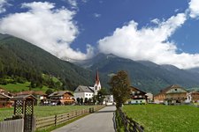
On a hot summer day we start from Anterselva di Mezzo to reach the Vedrette di Ries mountain hut at 2,792 m a.s.l. after a 4-hour walk. Having left behind the tree limit, we are completely exposed to the sun, which is why we start before dawn.
We walk past the Klammbach waterfall and the malga Bergeralm above and enter the forest. We follow signpost no. 3 and gain altitude. Having left behind the tree limit a wonderful view of the Valle di Anterselva, the Dolomites in the south and several peaks in front of us, such as the Schwarze Wand and Monte Magro, opens up.
We cross a small brook twice before reaching the Vedrette di Ries bivouac. From here it takes us about 50 minutes until we arrive at the Vedrette di Ries mountain hut which is still not visible from here. Shortly after we need to tackle wooden and rocky stair construction which is secured with a steel rope. At first we are happy to have a stable terrain under our feet, as until now, we walked only on a gravel path. However, you should definitely not underestimate the more than 800 steps you need to cover to reach the Vedrette di Ries mountain hut. The final section is very demanding! Having arrived at the Gemsbichljoch we see a small snowfield whose meltwater forms a small lake. Then, the path taking us to the hut proceeds above the lake and after a few minutes of walking we eventually arrive at the Vedrette di Ries hut at 2,800 m a.s.l. Because of the fresh mountain wind blowing here we decide to eat in the Stube of the hut.
Note: the Vedrette di Ries hut can be reached also from Anterselva di Sopra and Riva di Tures (approximately 4 hours of walking). Other popular destinations in the proximity of the hut are Monte Magro (3,273 m a.s.l.) and Monte Nevoso (3,358 m a.s.l.).
Date of the hike: 30 June 2020
Last updated in: 2026
Author: AD
-
- Starting point:
- Anterselva di Mezzo sports ground (1,261 m a.s.l.)
-
- Overall time:
- 07:00 h
-
- Total route length:
- 13,9 km
-
- Altitude:
- from 1.261 m to 2.798 m
-
- Altitude difference (uphill | downhill):
- +1537 m | -1531 m
-
- Signposts:
- no. 3
-
- Destination:
- Vedrette di Ries Mountain Hut (2,798 m a.s.l.)
-
- Resting points:
- Berger Hut (May to October), Vedrette di Ries Mountain Hut (June to September)
-
- Recommended time of year:
- Jan Feb Mar Apr May Jun Jul Aug Sep Oct Nov Dec
-
- Download GPX track:
- Hike from Anterselva to the Vedrette di Ries Mountain Hut
-
- More information:
- The total time indicated above refers to the walking time only, excluding breaks.
If you want to undertake this hike, we recommend checking the weather and trail conditions in advance and on site before starting this hike!