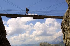
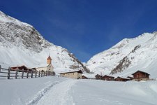
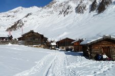
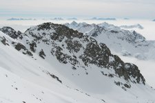
This hike leads to Mt. Picco della Croce (Wilde Kreuzspitze), the highest peak of the Fundres Mountains, from where you can enjoy a stunning view of Lago Selvaggio
Image gallery: Mountain tour to the Picco della Croce
The Picco della Croce (3.134 m a.s.l.), the final destination of today's hiking tour, is the main peak of the Fundres mountains and offers a spectacular round view of the Zillertal Alps. Our starting point is the car park of Malga Fane at 1,700 m a.sl.m. in Valles where the weather is still foggy. We take path no. 17 and walk past the alpine village of Fane Alm before entering the Valles gorge (Valser Schramme). On the right side of the gorge we can see a swishing brook and a small waterfall. Soon we arrive at a fork at 1,980 m a.s.l. where we continue to follow path no. 17 towards the Rifugio Bressanone mountain hut.
This hiking path leads us to Rifugio Bressanone at 2,282 m a.s.l. embedded among the Fundres mountains. After a short break with a wonderful view of Cima di Valmala right of the mountain hut, we continue our tour. Path no. 17B is also part of the famous "Pfunderer Höhenweg", a high-altitude path. We approach Rauhtaljoch pass in a large semicircle on the left. Besides being very steep, the path is also covered with scree and debris and requires sure-footedness along with a good physical condition. The passo Rauhtaljoch is still partially snow-covered but fortunately we don't need to cross these snowfields.
As we arrive at 2,807 metres of altitude we stop for a break and admire the fantastic view of the Fundres mountains. We continue hiking along path no. 18 towards Picco della Croce. From here it takes us only 45 minutes to reach our destination. The steepness of the path does not decrease and we have to stop several times to catch our breath. The wonderful view of lake Wilder See helps us to better tolerate the physical effort. We tackle the final ascent and after some more metres of elevation gain we finally reach the peak which delights us with a marvellous view of the Zillertal Alps.
After a long break on the summit we return to the valley. Initially the path proceeds steeply downhill towards passo Rauhtaljoch and until there we retrace our steps. Then we take path no. 18 towards the Wilder See lake and malga Labeseben. We approach the crystal-clear lake and continue walking along the left lakeshore. Having left this wonderful body of water behind us, we follow the signpost "Labeseben Alm". The path runs along several steps leading up to the malga at 2,100 m a.s.l. We proceed along a large forest path to the fork where we took the path to rifugio Bressanone (Brixner Hütte) this morning. We cross the Gola di Valles and return to our starting point. This hike can also be walked in the opposite direction.
Please note: Picco della Croce is a more than 3,000 metres high mountain which delights us with an exceptional view of the surrounding peaks and lake Wilder See. This hike requires a good physical condition and endurance, as well as sure-footedness. However, it is not particularly difficult for experienced hikers. The ascent across the Rauhtaljoch pass is very steep and slippery because of the snow! At the end of the valley before the ascent to passo Rauhtaljoch we recommend following the signposts carefully as you could easily get lost in this area! Hikers who would like to ascend to Cima di Valmala (3,022 m a.s.l.) can stay at the rifugio Bressanone overnight and continue their excursion on the next day.
Undertaken in: September 2009
Last updated in: 2026
Author: BS
-
- Starting point:
- Fane Alpine Village, Valles
-
- Overall time:
- 06:30 h
-
- Total route length:
- 16,0 km
-
- Altitude:
- from 1.744 m to 3.127 m
-
- Altitude difference (uphill | downhill):
- +1383 m | -1383 m
-
- Route:
- Fane Alpine Village - Gola di Valles gorge - Rif. Bressanone mountain hut - Rauhtaljoch saddle - Mt. Picco della Croce - Malga Labeseben hut - Fane Alpine Village
-
- Signposts:
- 17, 17B (Fundres High-Altitude Trail), 18
-
- Destination:
- Mt. Picco della Croce
-
- Resting points:
- Fane Alpine Village, Rif. Bressanone mountain hut, Malga Labeseben hut
-
- Recommended time of year:
- Jan Feb Mar Apr May Jun Jul Aug Sep Oct Nov Dec
-
- Download GPX track:
- Mountain tour to the Picco della Croce
If you want to undertake this hike, we recommend you to check the weather and trail conditions in advance and on site before setting out.


