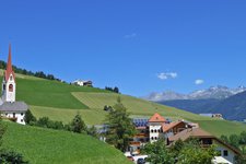
This tour leads from the hamlet of Sorafurcia near Valdaora to the eponymous mountain hut at 2,077 m asl
Image gallery: Plan de Corones circular hike

This tour is recommended only for experienced hikers with stamina and a good physical condition! The Berghotel Zirm in the hamlet of Sorafurcia (1,450 m a.s.l.) represents the starting point and final destination of our hike. We follow the asphalt road on the left into the forest - the marker indicating the intermediate station of the Valdaora Cable Car is red-white-red (no. 3). The path leads uphill through the forest past two farmsteads to an asphalt road. We always stay to the left and enter the forest again.
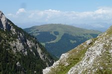
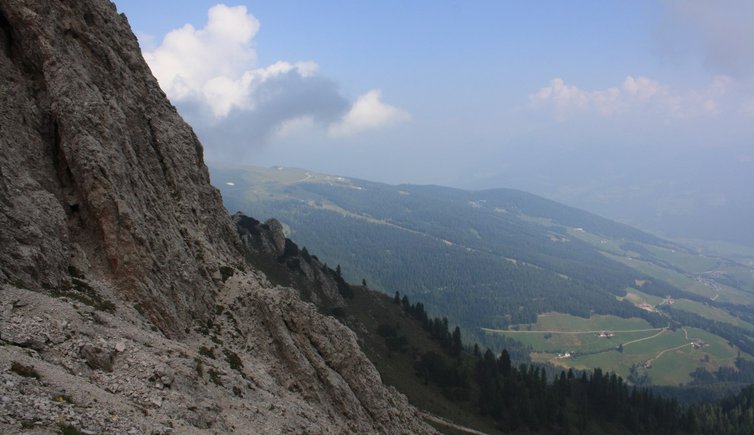
The trail snakes its way to the meadows beneath the Rif. Lorenzihütte mountain hut and crosses the Valdaora valley ski slope as a gravel path. We continue our ascent to the junction with the path no. 13 and further on to the next ski run. Staying on the right we reach the intermediate station of the Valdaora Cable Car. Past the station (on the left) the trail proceeds uphill to the Rif. di Sorafurcia mountain hut at 2,077 m a.s.l. where we stop for a picnic under the open sky - unfortunately the huts up here are closed in summer.
Afterwards we follow the gravel path on the left to the slope of the 2,507 m high Piz da Peres and cross another ski run. Staying on the gravel path we walk through the forest and in serpentines downhill to the Passo Furcia pass. Further downhill on the right we reach the path no. 1 branching off on the left towards the Rif. Furcia mountain hut (2,153 m a.s.l.), open from June to September. Past the hut the trail continues as an asphalt road uphill to the Passo Furcia, representing the border of the Fanes-Senes-Braies Nature Park and further on in serpentines downhill past the Baita Marchner mountain hut (1,560 m) to Sorafurcia, our starting point.
-
- Starting point:
- Berghotel Zirm, Sorafurcia near Valdaora
-
- Time required:
- 05:00 h
-
- Track length:
- 14,5 km
-
- Altitude:
- from 1.358 m to 2.088 m
-
- Altitude difference:
- +790 m | -790 m
-
- Route:
- Sorafurcia - Rif. Lorenzihütte mountain hut - intermediate station of the Valdaora Cable Car - Rif. di Sorafurcia mountain hut - Passo Furcia - Rif. Furcia mountain hut - Passo Furcia - Baita Marchner mountain hut - Sorafurcia
-
- Signposts:
- 3, 13, 1
-
- Recommended time of year:
- Jan Feb Mar Apr May Jun Jul Aug Sep Oct Nov Dec
-
- Download GPX track:
- Plan de Corones circular hike
If you want to do this hike, we suggest you to check the weather and trail conditions in advance and on site before setting out.