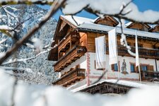
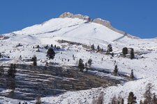
The Rina Mountain Hut, known in Ladin as Munt de Rina, is easy to reach from the village - an enjoyable outing
Image gallery: Hike from Rina to the Rina Mountain Hut


The sports ground above Rina, a small village known as Welschellen in German, is a popular starting point for walks in the Dolomites. Our route along the forest trail also begins here, taking us directly to the Malga di Rina in about an hour and a half.
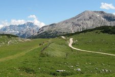
The hut, known in Ladin as Munt de Rina and in German as Welschellener Alm, is renowned for its good food, so we set off early in the morning on this bright August day. We follow wide forest track no. 26, from which steeper paths branch off in two places as shortcuts (no. 26A). Climbing steadily, the forest road leads us upwards at a relaxed pace until the mountain hut comes into view.
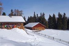
Tables and benches with parasols are dotted across the hillside at an altitude of 1,947 metres, surrounded by Swiss stone pines and providing views of Mt. Sasso di Santa Croce. An Alpine breakfast is available to pre-order - we first enjoy a refreshing aperitif with stone pine syrup, followed by an early lunch. The menu features dumplings, venison goulash, farmhouse speck, grey cheese, Kaiserschmarrn (shredded pancake), local Alpine yoghurt, and much more.
However, we opt for the daily special: Friday is Tirtlan day at the hut. For dessert, we treat ourselves to apricot dumplings dusted with cinnamon. If you want to continue walking from here, you can climb up to the mountain cross at Mt. Col dal Lech at an altitude of 2,175 metres - just beyond it lies Lake Rina. We, on the other hand, decide to end our leisurely walk here today.
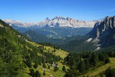
The descent takes us back along the same path to the sports ground above Rina. Every so often, the forest opens up to reveal views of the Dolomites. By early afternoon, we have already reached the car park and make plans for a relaxed summer evening in the Val Badia valley. The Munt de Rina is also a worthwhile destination for a winter walk during the colder months.
Author: MS
Experienced: August 2026
-
- Starting point:
- sports ground above Rina (1,434 m a.s.l.)
-
- Overall time:
- 02:30 h
-
- Total route length:
- 5,7 km
-
- Altitude:
- from 1.434 m to 1.947 m
-
- Altitude difference (uphill | downhill):
- +512 m | -512 m
-
- Signposts:
- forest track no. 26 (alternatively, the steeper forest path no. 26A as a shortcut)
-
- Destination:
- Rina Hut (Munt da Rina, 1,947 m a.s.l.)
-
- Resting points:
- Rina Hut (May to November)
-
- Recommended time of year:
- Jan Feb Mar Apr May Jun Jul Aug Sep Oct Nov Dec
-
- Download GPX track:
- Hike from Rina to the Rina Mountain Hut
-
- More information:
- The overall time shown above refers to the walking time only, not including breaks. The forest track itself is also suitable for pushchairs (provided they are all-terrain pushchairs).
If you want to undertake this hike, we recommend checking the weather and trail conditions in advance and on site before starting this hike!